30 Inundation-Prone Areas in Jakarta Mapped
access_time November 04 2018 07:00 PM remove_red_eye 1433
Reported by TP Moan Simanjuntak | Translated by Nugroho Adibrata
Reported by TP Moan Simanjuntak | Translated by Nugroho Adibrata
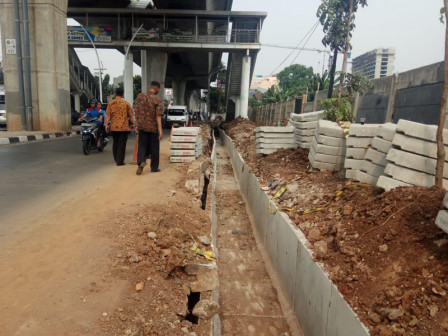
Jakarta Water Resources Dept. began mapping inundation-prone areas that spread in five cities in Jakarta. It is done to anticipate inundation in the rainy season.
Thus far 30 points of inundation-prone area are mapped
Jakarta Water Resources Dept. Head, Teguh Hendrawan stated that a number of inundation-prone areas have been mapped from Jl MT Haryono, Jl DI Panjaitan, Jl S Parman, Jl Gatot Subroto, and Jl HR Rasuna Said.
"Thus far 30 points of inundation-prone area are mapped," he expressed, Sunday (11/4).
600 Blue Personnel Alerted to Handle Puddles in N. JakartaNot only that, the dept. is also ready to alert 153 pump houses that spread in all over Jakarta.
"We also prepare 453 pump stations and 102 mobile pumps in inundation-prone areas," he told.
His dept. also continues to intensively drain the connecting channels during rainy season.