Sunter-Pulogebang Toll Road Procurement Data Being Collected
Reported by Budhi Firmansyah Surapati | Translated by Rizky Mawardi
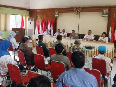
Jakarta Provincial Government is collecting data of Sunter-Pulogebang toll road construction procurement in Sunter Jaya Urban Village, Tanjung Priok, North Jakarta, Wednesday (7/10).
socialization was also carried out via zoom meeting
Sunter Jaya Urban Village Head, Eka Persilian Yeluma, said this initial data collection is a follow-up to the results of the inventory and location determination that was previously carried out.
Eka added that the validity period of Governor's Decree number 140/2023 concerning land acquisition for the construction of the Sunter-Pulogebang section of the Jakarta inner city toll road has ended in February 2024.
"Therefore, initial data collection is carried out again in order not to violate the rules. Prior to this, socialization was also carried out via zoom meeting," she added.
Eka explained that this follow-up process would be accelerated so that the payment process would no longer be delayed. Therefore, he hopes that RT/RW officials and their residents can support and make the land acquisition process a success.
Jakarta Provincial Secretariat Government Bureau's Accusation Group Head, Agus Saputra, is targeting the initial data collection process to be completed within three days and followed by public consultation.
Agus asked RT and RW officials in the affected areas to help the committee carry out field verification. Apart from fulfilling applicable regulations, this is also to update developments in land ownership data if anything is missed or left behind.
"Because this is not the first time, we can speed up the process so we can immediately carry out public consultations. If everything goes smoothly, a new decree can immediately be issued from the governor regarding the inventory and location determination.
The data held by the committee is that there are a total of 404 plots of land with a total area of 27,857 square meters spread across RW 01, 02, 03, 05, 06 and RW 07, Sunter Jaya Urban Village.
"Technically, all affected land is divided into four map fields," he said.
Later on, every RW and RT in the affected area will be distributed a plot map made by the committee for verification. The results of the verification are reported to the Land Acquisition Preparation Team (TP2T) for data updating.

