Dishub Launches Web-Based Traffic Information
Reported by Aldi Geri Lumban Tobing | Translated by Nugroho Adibrata
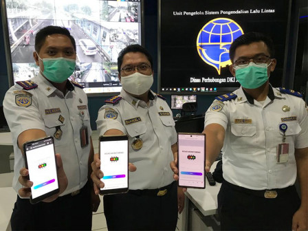
The Jakarta Transportation Agency (Dishub) has launched a web-based Traffic Performance Monitoring Information System (SIPKLL). Residents, especially motorists, can easily access and know the traffic flow conditions on a number of roads in Jakarta in real time, simply via a smart phone or personal computer (PC).
It can also be used for decision making and policies related to traffic or transportation, like odd-even traffic system, etc,
To use it, they simply access the site roadmonitor.revolusi-it.com. Then, include the username with the password, 'user'. If the public has difficulty accessing this site, they may contact the call center at 021-3844022.
It also provides data on the speed, volume and traffic density of each road segment. Interestingly, it also has features that are connected to closed circuit television camera (CCTV) on many roads. Thus, motorists can see traffic conditions and look for alternative roads or routes when they find a congestion point.
Dishub Closes Railroad Crossing on Jalan Tentara Pelajar PermanentlyTraffic Control System Management Unit (UP SPLL) Head Emanuel Kristanto explained it was connected to 42 CCTV points on 21 roads.
"We have 207 CCTV points, that means we will continue to optimize the integration or development in systems with adequate infrastructure by adding servers and storage. The input is fast but not everything can be recorded due to limited storage and servers," he expressed, Friday (12/11).
He explained, it was capable of helping the Transportation Agency internally to obtain traffic speed, volume and density data efficiently and effectively.
"Moreover it can take eight to ten hours to obtain data on speed and traffic density. But, with this system, this is done by simplifying the data collection procedure," he explained.
Aside that, it allowed anticipatory steps to problems in the field quickly and precisely.
"It can also be used for decision making and policies related to traffic or transportation, like odd-even traffic system, etc," he described.
He assessed, it combined the Google Cloud System from smartphone users and Google Maps, then integrated it into CCTV which had been processed through a video processor.
"It utilizes smartphone users who drive around Jakarta, thus we know the data on speed, volume and traffic density on the roads. We connect again with the facilities we have such as CCTV on the roads where we have installed a video processor using artificial intelligence technology," he uttered.