Makasar PPSU Makes Water Level Indicators in Flood-Prone Areas
Reported by Nurito | Translated by Maria Inggita
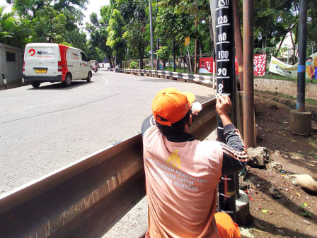
Makasar Sub-district PPSU personnel, East Jakarta, make water level indicators in several flood-prone points, including in Cipinang Melayu, Makasar, and Kebon Pala Urban Villages.
This way, residents and personnel can know water level or depth of flooding
Makasar Sub-district Head, Kamal Alatas stated, those water level indicators can help residents or related personnel to know water level or depth of flooding thus they can determine whether it is still safe for people and vehicle to cross the inundated area.
"This way, residents and personnel can know water level or depth of flooding," he mentioned, Wednesday (10/27).
400 Joint Personnel Join Gerebel Lumpur Program in Tanjung PriokIn Makasar Urban Village, water level indicators were marked using oil paint on number of utility poles or intersection with average height of 150 centimeters above road surface. His side made water level indicators on Jl. Tipala RW 05 and Jl. Pusdiklat Tenaga Kerja RW 07.
Cipinang Melayu Urban Village Head, Arroyantoro conveyed, water level indicators were made in 3 locations, namely Jl. Nurul Iman RT 04/04, Jl. H. Sulaiman bordering RW 02 and 03 located in RT 01/03, and Jl. H. Amsir RT 02 RW 04.
"We make water level indicators both in river and road. It can be used for comparison between water level in river and inundated area," he said.

